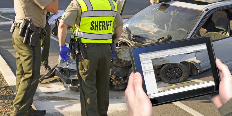
In recent years, advancements in technology have significantly transformed various aspects of law enforcement. One such innovation making waves in crash scene investigations is the use of RTK (Real-Time Kinematic) GNSS tablets. These cutting-edge devices are revolutionizing the way police departments document and clean up crash scenes, leading to reduced traffic congestion and increased officer safety.
Here’s how RTK GNSS tablets make an impact in crash investigations and how they are transforming the Fort Wayne Police Department’s approach to this critical task.
Enhanced Efficiency through Rapid Documentation
Traditionally, crash scene investigations involved meticulous manual measurements, sketching, and note-taking. However, with the integration of RTK GNSS tablets, the process has become significantly more efficient. These purpose-built tablets utilize precise GPS technology, allowing officers to accurately document the crash scene with speed and precision.
Equipped with intuitive software, RTK GNSS tablets enable officers to capture crucial data such as vehicle positions, skid marks, debris distribution, and road conditions in real-time. The tablets also enable officers to annotate images, mark evidence, and even create 3D reconstructions of the scene. By eliminating the need for manual measurements and sketching, RTK GNSS tablets streamline the documentation process, enabling officers to quickly gather essential evidence.
Reduced Traffic Congestion
The time saved through the utilization of RTK GNSS tablets has a direct impact on traffic congestion. By expediting the documentation process, crash scenes can be cleared faster, allowing traffic to flow more smoothly. This is especially crucial in busy urban areas where traffic congestion can lead to significant disruptions and delays for motorists.
With RTK GNSS tablets, officers can efficiently record the necessary information without prolonged road closures, resulting in reduced inconvenience for drivers and minimized traffic backups. The tablets also enable officers to make well-informed decisions regarding the deployment of resources, such as tow trucks and emergency services, further facilitating the swift clearance of crash scenes.
Improved Officer Safety
Crash scene investigations pose inherent risks to officers, who often work in close proximity to traffic. By utilizing RTK GNSS tablets, officers can minimize their exposure to potentially dangerous situations while gathering critical evidence. The tablets allow officers to document the scene from a safer vantage point, reducing the need to venture into high-traffic areas.
Furthermore, the RTK GNSS tablets enhance situational awareness by providing real-time data and visualizations. This enables officers to make informed decisions quickly and efficiently, ensuring their safety while carrying out their duties.
The integration of RTK GNSS tablets into crash scene investigations has revolutionized the way law enforcement agencies document and clean up accidents. With their ability to streamline the documentation process, these tablets significantly improve efficiency, reduce traffic congestion, and enhance officer safety.
The DT301Y-TR and DT382GL-TR Rugged GNSS Tablets’ compact designs and 10″/8″ touch screens, make them ideal for GIS mapping tasks. These rugged tablets are equipped with Real-Time Kinematic (RTK) satellite navigation, which significantly enhances the accuracy of satellite-based positioning systems. With centimeter-level precision, these specialized tablets enable the creation of 3D Point Clouds that meet the rigorous standards required for presenting scientific evidence in court.
The Fort Wayne Police Department’s adoption of this technology serves as a testament to its effectiveness in expediting crash investigations. As technology continues to advance, it is expected that RTK tablets and similar innovations will become standard tools for law enforcement agencies nationwide, further improving the effectiveness of crash scene investigations and ensuring safer roadways for all.

