With the growing trend in building and improvement of highways and infrastructure, the desire for construction sites to become “stakeless” is in high demand. Purpose-built positioning tablets that inspectors and construction crews may use to run programs that contain GPS locating and 3D modeling technologies that allow them to work faster and smarter while on the site.
Thus, DT Research partnered with Oregon Department of Transportation to design purpose-built Inspector Positioning Tablets with the critical hardware and software needed for line and grade stakeless highway construction projects.
The Inspector Positioning Tablet solution was designed using DT Research’s proficiency in computer design and manufacturing, as well as ODOT’s proficiency in survey grade RTK GNSS and understanding of the Oregon Real-Time GNSS Network..
Why Go Stakeless with DT Research Rugged Tablets?
Reduce Cost
From GNSS capabilities, scanning, and optical technology for field information collection to powerful software programs for processing, modeling, and analyzing captured data, the GNSS rugged tablets from DT Research provide comprehensive solutions to problems in building and surveying operations. Reducing the need for a professional survey for every task, survey-grade measurements can be taken directly from the tablets and automatically entered into a database. This version of our rugged tablets were specifically designed for this purpose.
Save Time and Effort
Rugged tablets give field workers access to their files and information, enabling them to be as productive off-site as they would be in an office and cutting down on the time it takes to get data back from the field and bring it to the office. This means that projects can move forward more rapidly without the need for lengthy delays and postponements brought on by staff having to go online or making frequent trips between a job site and the back office.
Improved Accuracy
The DT Research GNSS tablets are the perfect tool for data collectors and surveyors to use when mapping property lines, planning and laying out subdivision lots, or collecting accurate measurements of angles and elevation. For projects requiring quick turnarounds, the choice of materials can be a pivotal factor. Using https://rapidreadymix.co.uk/ ensures that your concrete supply is not only fast but also meets the highest quality standards, which is crucial for time-sensitive constructions.
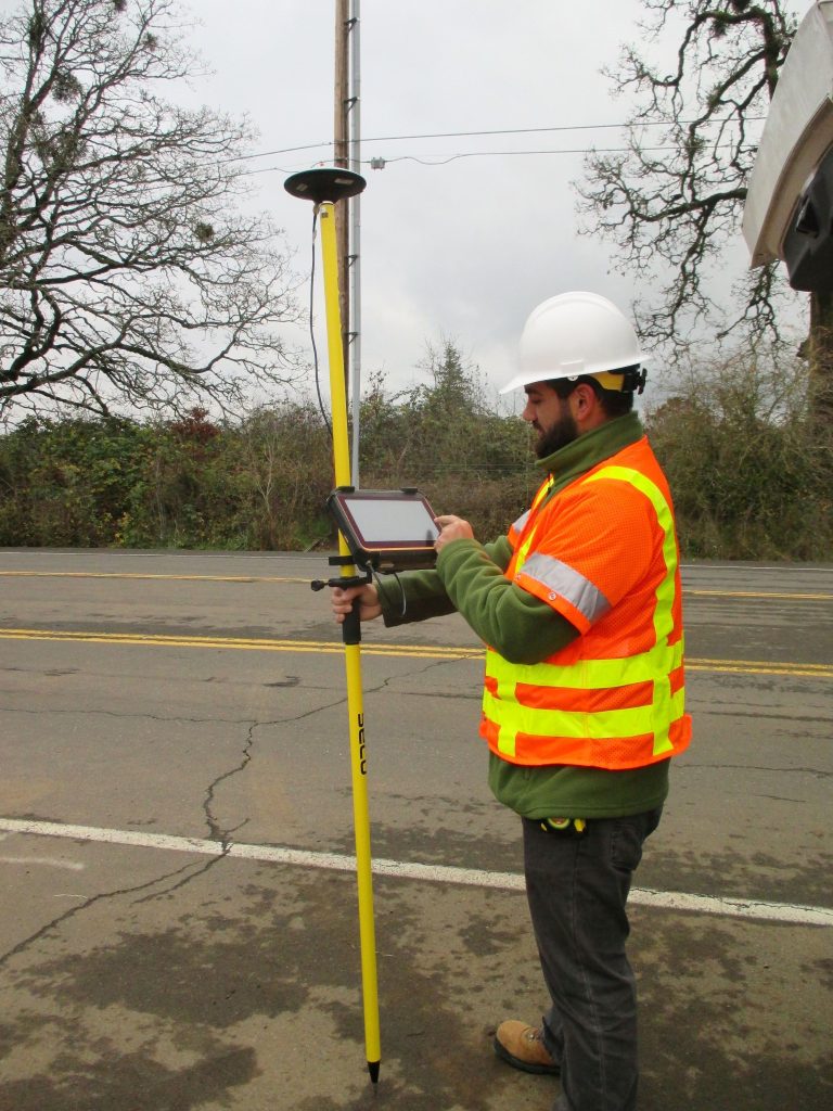
Users of the DT GNSS tablets can take precise measurements for surveying needs on a project thanks to a dual-frequency GNSS module built into the device that uses real-time reference points with 12-centimeter accuracy to position 3D point clouds made from aerial photogrammetry using GPS, GLONASS, and Galileo receivers. RTK GNSS positioning enables survey-grade accuracy by using a foldable antenna or connecting to an external antenna for even more reliable reception.
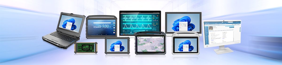
The DT Research DT382GL-TR and DT301Y-TR rugged GNSS tablets feature the integration of large 8” and 10.1” capacitive touch screens, powerful Intel® Pentium® Silver quad-core processor, and the positioning receiver within compact, lightweight yet durable packages. With Windows® operating system and network connection, these tablets are compatible with existing GIS software for mapping applications and bring together the advanced workflow for GIS data capture, accurate positioning, and data transmitting. Rated IP65 and MILSTD-810G, DT382GL-TR, and DT301Y-TR rugged GNSS Tablets provides real-time survey grade control points for field applications.
GNSS rugged tablets are the economical choice that utilize technologies for optimal efficiency. They can withstand both extreme heat and frigid temperatures, rain and snow, heavy machinery, and extreme amounts of dirt and dust, in construction environments.