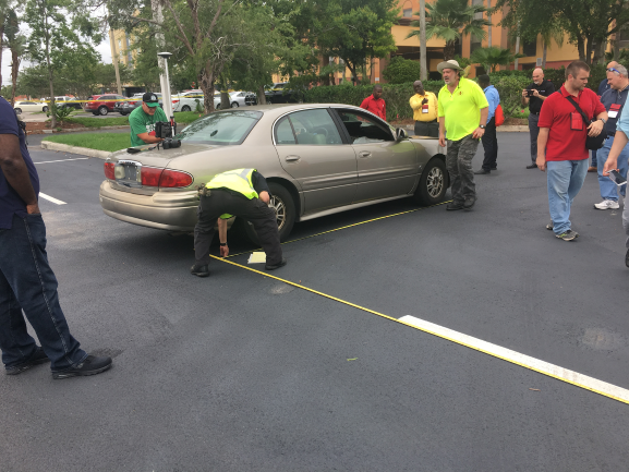
Forensic science is defined as the application of both science and law. For crime scene or accident reconstruction experts, forensic mapping technology enhances forensic disciplines with the use of electronic surveying equipment to measure and collect information before it vanishes. It is often the forensic crime labs that hold the chief responsibility in criminal investigations to collect evidence with the right tools and document evidence precisely for additional analysis.
Forensic Mapping
Forensic or Crime Scene Mapping, also known as forensic mapping, is considered the most sophisticated technological advancement for crime scene documentation or crash reconstruction because it can collect, measure, and survey an area with greater accuracy than personnel. Forensic mapping also allows for constant reproducibility as the DT Research purpose-built tablets recall details that humans cannot.
For forensic scientists and investigators, accuracy is the most vital part of their jobs, but it is not always easy to achieve when they lack the right mapping tools. Forensic mapping has improved efficiency because of technology like our rugged tablets that detect evidence and use geospatial technology to document a setting, measure terrain, or define autonomous geospatial positioning.
Forensic Mapping Tools
A fundamental forensic mapping tool is often referred to as a total station, which is used to survey crime scenes and crash sites. Surveyors can measure data, calculate the distance to motion, determine object positioning, compute vehicle speed, and perform photogrammetry in 3D. While defense attorneys can argue against collection technique, technology is credible and has proven more accurate because our forensic mapping tools deliver efficient analysis services.
DT Research Rugged Tablets
For investigators and industry experts, it is necessary to utilize premier forensic mapping tools like DT rugged tablets, which offer analogous capabilities and provide crime scene and crash reconstruction specialists with the right hardware and software to measure data and collect evidence on-site. GNSS, in particular, provides a 3-D system for photo and geodetic control.
As our purpose-built tablets document evidence in several dimensions, it allows the forensic scientists to record any proof and save it within a controlled database. The use of GNSS technology and front and back cameras also allow any additional investigations to take place virtually. As experts are trained to survey and scan a scene precisely and methodically, it also becomes a reliable witness.
Forensic investigators will only have to carry a lightweight tablet to a scene rather than the bulky 2 and 3-D scanners, evidence recorders, mapping diagrams, speed and portability scanners, lasers, and sketching kits. Why would a crime scene or crash site personnel want to carry all of these tools when a rugged tablet performs these duties along with Bluetooth and GNSS frequency?
DT Research rugged tablets also capture several mapping data types, so it will ensure crime scene and crash specialists have the right technology when it is required. GNSS technology will also be helpful when sending workers into rural or remote locations. Because the data is also on a CPU, workers can export the data to multiple departments which will improve workplace efficiency.
Whether used for law enforcement or the forensic mapping private sector, DT Researchs purpose-built Tablets can be used to augment workflow and broaden the scope of expert data collection and scene surveyance.

