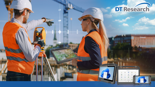
Infrastructure modernization is a critical priority worldwide, driven by the need to improve aging systems and meet the demands of growing populations. Rugged GNSS (Global Navigation Satellite System) tablets are revolutionizing this space by empowering professionals with tools that combine precision, durability, and cutting-edge technology.
Rugged GNSS tablets, are durable, weather-resistant devices equipped with high-precision Global Navigation Satellite System (GNSS) technology for accurate geolocation and mapping. Designed for fieldwork, they combine advanced computing power with enhanced GPS capabilities, ensuring reliable performance in challenging environments.
Let’s explore how these rugged devices are shaping the future of infrastructure development, reducing project risks, and enhancing outcomes.
The Modernization Imperative
Modernizing infrastructure isn’t just about building anew and improving efficiency, sustainability, and resilience. Challenges such as aging roads, bridges, and utilities, tight budgets, and growing regulatory demands require innovative solutions. Rugged GNSS tablets fit perfectly into this transformation, enabling real-time data collection and analysis for smarter decision-making.
Key Advantages of Rugged GNSS Tablets in Infrastructure Projects
1. Enhanced Precision in Surveying and Mapping
GNSS-enabled rugged tablets offer unparalleled accuracy for land surveying, geospatial mapping, and construction planning. These flexible tablets eliminate guesswork, reducing the risk of errors in large-scale projects like highways and pipelines.
2. Durability in Extreme Conditions
Infrastructure work often occurs in challenging environments, from dusty construction sites to wet, cold, or hot conditions. Rugged tablets are designed to withstand these extremes, ensuring reliability when conventional devices might fail.
3. Integrated Workflows
Modern tablets integrate seamlessly with Building Information Modeling (BIM) tools and project management platforms. This connectivity streamlines workflows, enhancing collaboration among contractors, engineers, and stakeholders.
4. Cost and Time Savings
By providing real-time data and facilitating immediate adjustments, rugged GNSS tablets reduce project delays and budget overruns. For instance, these devices help avoid costly rework by pinpointing discrepancies early in the process.
5. Improved Safety
On-site workers can use rugged tablets to access updated safety guidelines, perform inspections, and report hazards in real time. This contributes to safer job sites and better regulatory compliance.
Applications in Infrastructure Modernization
Transportation
Highway expansions, bridge repairs, and rail improvements benefit from GNSS tablets’ precise geolocation capabilities, ensuring projects stay aligned with design specifications. For example, they help in creating detailed maps for detour planning, reducing public inconvenience.
Utilities
From water systems to energy grids, rugged tablets streamline inspections and maintenance. They enable utility teams to pinpoint faults quickly, minimizing service disruptions and ensuring efficient resource use.
Urban Development
Smart city initiatives rely on data-driven planning. GNSS tablets facilitate urban development by providing accurate geospatial data for zoning, construction, and infrastructure upgrades.
Disaster Recovery
Infrastructure modernization often overlaps with disaster recovery. Rugged tablets are invaluable in post-disaster assessments, helping crews assess damages and plan repairs swiftly and efficiently.
Future Trends: Digital Transformation and Smart Infrastructure
The construction and infrastructure industries are at an inflection point. Historically slow to adopt technology, the sector is now embracing tools like rugged GNSS tablets to drive digital transformation. As governments and private entities push for transparent, efficient use of funds, technology adoption will continue accelerating.
Upcoming trends include:
- Integration with Drones: Combining rugged tablets with drone technology for aerial mapping and monitoring.
- AI-Driven Insights: Using rugged devices as a hub for AI analytics to predict maintenance needs and improve resource allocation.
- Sustainability Tracking: Monitoring environmental impacts using GNSS data, ensuring compliance with green construction practices.
Building the Future with Confidence
Rugged GNSS tablets are transforming how infrastructure projects are planned, executed, and maintained. By enabling precise data collection, fostering collaboration, and promoting resilience, they reduce risks and unlock efficiencies. As modernization efforts continue worldwide, these devices are essential for shaping smarter, more sustainable infrastructure.

